Thursday, 26 March 2020

Down Along the Border - Part#2

From last Saturday, before my wings were clipped.
Riddings Railway Station on the old Carlisle to Edinburgh railway line. Now a private house. The "Speed and Comfort by Rail" sign (just about) remains.

Entering Scotland on the A7 Carlisle to Edinburgh road

This post has many stickers from passing scooter clubs

Firewood for sale with an honesty box in Canonbie. Ah, country folk.

I don't associate this area with coal mining but this old winding gear commemorates a man killed in the pit.


Liddel Water forms the border at Penton Bridge
  
Liddel Water at Kershopefoot 
<-Scotland...England->

Just south of the border is Stonegarthside Hall. It dates from 1682 but might be based on a 13th century tower house. It has been described as ‘arguably the most remote country house in England’.

"Keep Scotland Bonnie"

Saturday, 21 March 2020

Down Along the Border - Part#1

I'm taking the opportunity of some decent early spring weather to get out for a run before a national lock-down is ordered. I suppose riding about on a bike neither risks getting nor spreading the plague. I did take the precaution of wearing gloves while refuelling - the pumps must be pretty dodgy.

There are a number of roads that cross the Scotland/England border - 25, I think. Here I'm doing the crossings and seeing if there is anything interesting at or near them. I'm travelling west to east.  

The first crossing is this bridge over the River Sark in Gretna.

Due to differences in the marriage laws between Scotland & England Gretna is know for weddings. The Old Toll Bar has carried out 10,000 weddings since 1830.

The border at the main west coast road - The M6.

The SV on the old Plump Bridge at the border near Springfield.

Old cast iron road sign

The Debateable Lands are a strange part of British history. For 300 years there was a small area of land on the border ruled by neither Scotland or England. In the area (only 10 miles long by 4 miles wide) lawless families or Reivers raided both kingdoms. The situation ended in 1552 when the Lands were divided between Scotland & England. The division was marked with a low, wide earthworks called Scot's Dike. It is now this plantation of trees.

St Andrew's church on the English side

There is a very spindly bridge over the River Esk to the church.

No crowds

The bridge was built for access to the bridge from a nearby stately home. No plebs allowed!

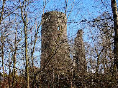
Kirkandrew Tower is a 16th century fortified house now a private residence.

Thursday, 19 March 2020

Brewgel Punk Sanitiser

Here is a good story to come out of the current virus crisis.   


Scottish brewer BrewDog are making hand sanitser at their Distillery in Aberdeenshire. BrewGel Punk Sanitiser will be distributed free to those who need it. (story here)

Other distilleries are also making sanitiser - Verdant Spirits in Dundee, Psychopomp in Bristol and 58 gin in London - the most effective sanitsers being alcohol-based. (story here)

 Gin sanitiser

Saturday, 7 March 2020

Raintown #3 - The Numbers are In

The Met Office has published the weather statistics for Glasgow and, as I predicted, records were broken.

In February 316mm (12.4") of rain fell - three times the average. This is the wettest February recorded easily beating the 1997 figure of 250mm. It is also the wettest month on record exceeding December 2006 which had 299mm of rain. The records are for the airport and date back to 1959.

The upside to the rain was that it was relatively mild with only a single day of frost.

The rain affected most parts of the country with some area still flooded. Despite the rain the effect on Scotland wasn't too bad. I think our hilly landscape means that there are fewer floodplains. 

Heavy rain affected most of the country


Thursday, 5 March 2020

Some Local Sights

At long last the weather is not quiet so grim. Some blue skies and dry roads. It's too cold to go any distance but I get out locally when I can and here are some sights I snapped.


Strathaven Castle. This is located in the middle of a local town. It's an austere lump of stone. The gates were locked. Maybe because the building is dangerous.  


 I got some information on the castle from a book I bought recently in a charity shop.   

 
It was built in the mid 15th century and occupied until 1716. A grisly story is that when a wall collapsed in the 19th century a skeleton was found bricked up inside. Legend is that it was the remains of a wife who had displeased the lord of the castle. There is no proof of this.   


I fiddled with my camera settings to get this dramatic picture. This may look like a scenic Scottish loch but it's not. It's a flooded quarry near Airdrie.


Finally a bridge. Well, the remains of one. These are the columns of the Rotten Calder railway viaduct. This carried the branch line between Blantyre and East Kilbride. I passed near this for many years commuting to work but never saw it. It's located in a heavily wooded valley. Winter will be the best time to see it.